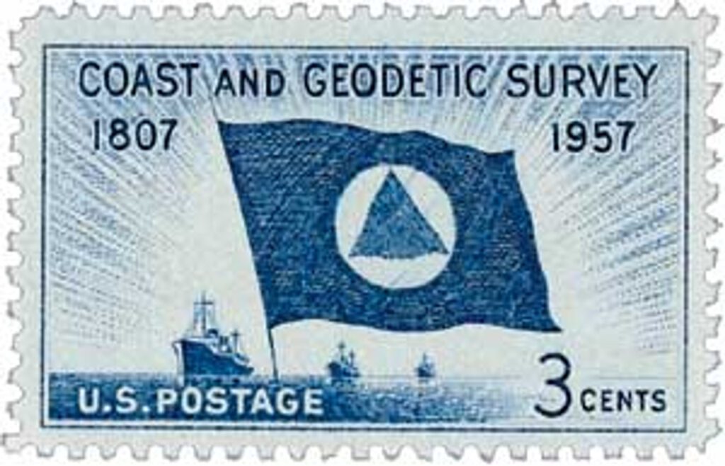
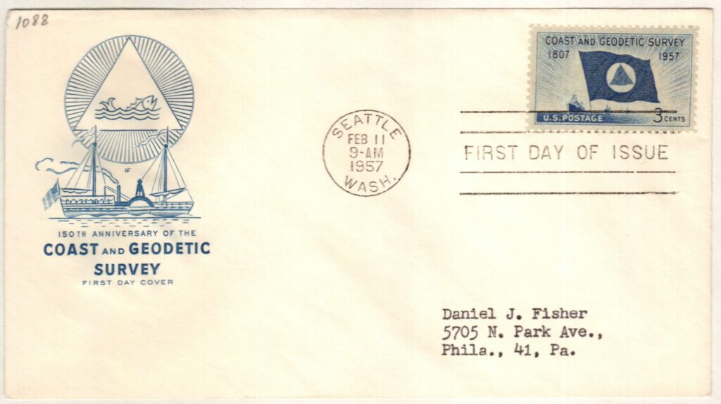
On February 10, 1807, President Thomas Jefferson signed legislation to establish the United States Survey of the Coast. This later became the US Coast and Geodetic Survey and eventually the National Geodetic Survey.
Well before 1807, other nations had done their own coastal and geodetic surveys. Geodesy is the science of measuring the Earth’s shape, orientation in space, and gravitational field. Swiss-born Ferdinand R. Hassler immigrated to the US in 1805 and proposed the creation of a government agency to explore this field of science.

President Jefferson agreed with Hassler and signed an act into law on February 10, 1807, calling for a “Survey of the Coast.” This was America’s first scientific agency. Jefferson hoped it would aid international trade by charting US waters and making them safe for navigation. Hassler, with expertise in surveying and the standardization of weights and measures, was selected to lead the survey.
However, after Hassler submitted his plan for the survey just a month later, the Embargo Act of 1807 essentially halted all US overseas trade. The project was put on hold until 1811 when President James Madison authorized Hassler to travel to Europe to purchase the instruments needed for the survey. While Hassler was in England, the War of 1812 broke out and he was forced to stay there until it ended in 1815.
Nearly a decade after it was created, the survey finally began operations in 1816. Hassler began his work near New York City, measuring the first baseline and verifying it the following year. However, by 1818, Congress was unimpressed with the progress that had been made in the first decade of the agency and was unconvinced it was worth the cost. They fired Hassler and placed US Army and Navy officers in charge of the task. No surveys were conducted for the next 14 years.

In 1832, Congress reverted to the original law and returned the responsibility of coastal surveying back to the Survey of the Coast and authorized the hiring of civilians once again. Hassler resumed his work in 1833. In 1836, the agency was renamed the US Coast Survey. Around this time they also worked in coordination with the Navy – a new law required that survey ships be commanded and crewed by US Navy officers and men when they could provide that support.
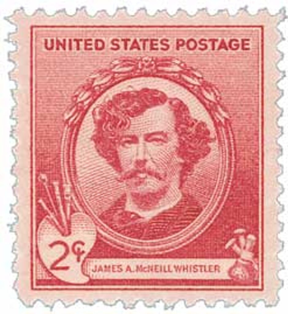
Over the years, the agency produced nautical charts, performed the first systematic study of the Gulf Stream, created tidal prediction machines, and established a geodetic connection between the Atlantic and Pacific coasts. In the 1850s, artist James McNeill Whistler worked briefly as a draughtsman for the agency. The outbreak of war would slow the work of the agency, as the US Navy and Army personnel were called away. In peacetime, they resumed their work together. After the US acquired Alaska in 1867, the survey had even more coast to explore.
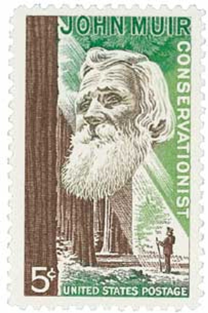
In the 1870s the agency’s responsibilities were increased to include geodetic surveys in the country’s interior. Between 1874 and 1877, naturalist and author John Muir served as a guide and artist for the survey of the 39th Parallel. It was also during this period that the name was changed to the US Coast and Geodetic Survey.
From 1900 to 1917, the Navy was removed from the survey and it was operated entirely by civilians. Then with the US entrance into World War I, the US established the Coast and Geodetic Survey Corp. This gave the survey’s officers a commissioned status to protect them from being treated as spies if they were captured. After the war, they returned to land surveying, seafloor charting, mapping coastlines, geophysics, and oceanography. In 1926, the survey entered a new age with the passage of the Air Commerce Act, which directed them to chart US airways for the first time. During the Depression, the survey established surveying parties and field offices that provided jobs for more than 10,000 people, including many out-of-work engineers.
During World War II, over 1,000 members of the survey joined the war effort as hydrographers, artillery surveyors, cartographers, army engineers, intelligence officers, and geophysicists. In 1959, the survey’s charter was expanded to explore oceans worldwide. In 1970, the National Oceanic and Atmospheric Administration (NOAA) was established. The survey was merged with other agencies and became the National Geodetic Survey and the Office of Coast Survey. The Dictionary of American History stated that “the Survey is considered to have been one of the major birthplaces of modern American science, including many disciplines not generally associated with geodesy and hydrology. Its creation is a cornerstone of the rapid growth of science and technology and of the development of natural resources for commercial use in the United States.”
| FREE printable This Day in History album pages Download a PDF of today’s article. Get a binder or other supplies to create your This Day in History album. |
Discover what else happened on This Day in History.
Why does the counter not work?
Hey Otto, are you referring to the “Do you like this article” counter?
Click to rate not opening.
Where is the tab to go to previous Day in History?
So happy to see these articles back, thank you Mystic