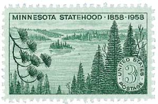
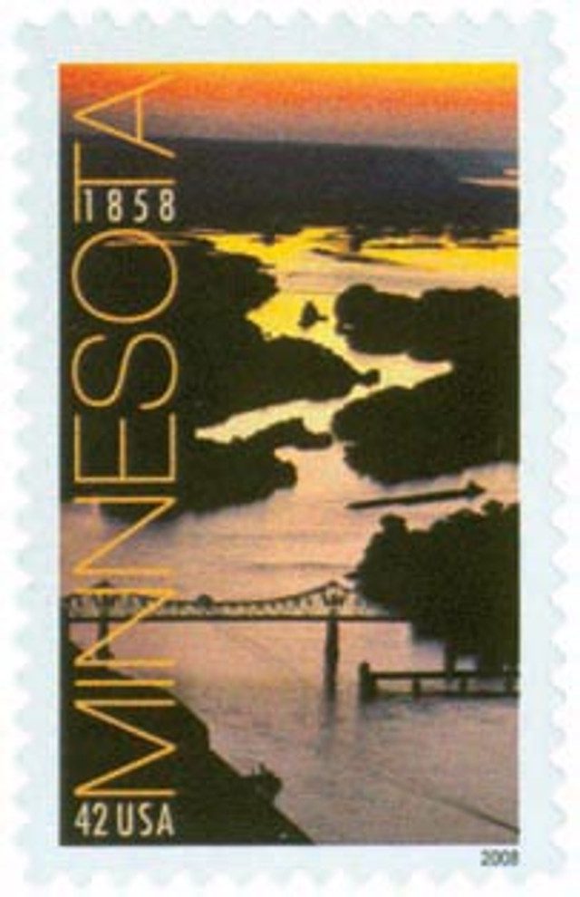
Minnesota was admitted to the Union on May 11, 1858.
When the first Europeans arrived in Minnesota in the second half of the 1600s, the Sioux Indians dominated the northern portion of the state. By the mid-1700s, Chippewa Indians moved into the area from the east, pressured by the expanding population of Europeans, and displaced the Sioux to the south. The Sioux were forced into a nomadic lifestyle, wandering the southern plains.
Around 1660, the French fur traders Pierre Esprit Radisson and Médard Chouart, Sieur des Groseilliers, became the first Europeans to reach Minnesota. French adventurer Daniel Greysolon, Sieur Du Lhut – also simply called Duluth – entered the area in 1679, looking for a water route to the Pacific Ocean. Duluth landed on the western shore of Lake Michigan and claimed the entire area for King Louis XIV, naming it Louisiana in his honor. In 1680, Sioux Indians captured the Belgian missionary Father Louis Hennepin and his two companions while they were exploring Illinois. The Sioux brought the men to Minnesota. Although captives, the men were able to see much of the region, and were the first whites to reach the site of today’s Minneapolis. When Duluth learned Hennepin and his men had been captured, he found the Indians and bartered for their release.
Spain acquired all of France’s land west of the Mississippi – the Louisiana Territory. This included much of present-day Minnesota. However, Spain did very little to explore and promote settlement. As a result, French trappers continued to expand their prosperous fur trade there. When the French and Indian War ended in 1763, the British gained control of all French lands east of the Mississippi, which includes eastern Minnesota. In 1783, when the American Revolutionary War ended, Great Britain gave the United States all of its lands south of the Great Lakes and east of the Mississippi. This area became part of the Northwest Territory. However, British fur traders continued to control the area. The U.S. gained control of the Northwest Territory at the conclusion of the War of 1812.
In 1800, France regained control of the Louisiana Territory, from Spain. Three years later, when France was badly in debt, Napoleon sold Louisiana to the U.S. In 1805, Zebulon M. Pike was sent to explore the northern area of Louisiana, which included the Minnesota wilderness.
In 1819, Fort Saint Anthony was built at the junction of the Mississippi and Minnesota rivers. It was renamed Fort Snelling in 1825. This fort served both as a military center and as a base for western exploration. The first white people to make permanent homes in Minnesota were farmers who lived in and around the fort.
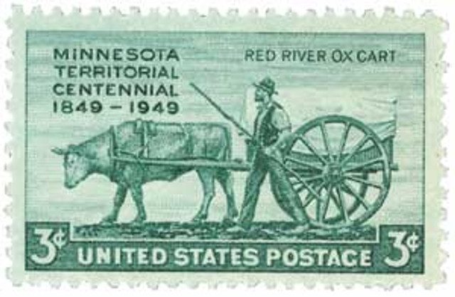
Before 1849, Minnesota’s boundaries had changed many times, including parts of Illinois, Indiana, Iowa, Michigan, Missouri, and Wisconsin. On March 3, 1849, the Territory of Minnesota was created. Its northern, eastern, and southern boundaries were the same as the state’s are today. However, its western limits extended to the Missouri and White Earth rivers, which includes most of the state of North Dakota. About 4,000 people lived in Minnesota when it became a U.S. territory.
In 1851, the U.S. government forced the Sioux Indians to leave their lands west of the Mississippi. The majority of this land was in southern Minnesota. Many white settlers quickly poured into the newly vacated area.
This influx of settlers led many to call for statehood. It was delayed for some time because there was great debate over whether Minnesota should be admitted as a slave or free state. Even the people of Minnesota were split on the issue, with representatives from each side drafting their own constitutions and refusing to sign the others. Eventually, Minnesota was admitted as a free state on May 11, 1858 with state had a population of about 150,000.
Minnesota was the first state to offer troops to the Union when the Civil War erupted in 1861. In August 1862, while a many of of Minnesota’s men were fighting in the war, the Sioux Indians began attacking settlements there. A great deal of property was destroyed, and about 500 settlers were killed. Federal troops and Minnesota militiamen put down the uprising.
With the conclusion of the Civil War in 1865, Minnesota’s economy began to expand rapidly, fueled by industrial development. Railroads were built across the state. Huge crops of wheat were planted, and flourmills were built. Most of these mills were located near Minneapolis. These mills produced so much flour that Minneapolis became known as the Mill City. During the late 1800s, the state’s economy received a huge boost from the growth of iron ore mining.
Minnesota started an aggressive effort to attract more settlers. The state government and railroad companies advertised in Europe, featuring the economic opportunities of Minnesota. Between 1870 and 1900, thousands of immigrants arrived in Minnesota. The majority of these people came from Germany, Norway, Sweden, and Finland.
During World War I, Minnesota’s iron ore and wheat were essential to the war effort. Huge crops were grown, and record amounts of ore were produced. The Great Depression was especially hard on the state. About 70 percent of ironworkers lost their jobs. During World War II, the economy began to flourish again as iron ore and wheat were needed for the war effort.
In the 1950s and ’60s, many new industries began operating in Minnesota. These included aerospace, chemical, computer, electronic, heavy machinery and processed food businesses. During the 1970s and ‘80s, the state grew increasingly concerned with how to maintain its economy and utilize its natural resources while preserving its natural beauty and the environment. As a result, new methods of waste treatment were created for iron ore mining, and wastes were no longer dumped into Lake Superior.
Minnesota’s industrialists continue to look for ways to expand mining and logging operations. However, environmental groups often oppose the suggested expansions. Declining prices during the 1980s hurt Minnesota’s farmers, as well as farmers across the U.S. This crisis has led to the decline of many of the state’s rural areas.
Discover what else happened on This Day in History.
Interesting history previous to the annexation of Minnesota but it sounds so familiar. Could it be that you plagiarized Dr. Gabriel Des Rosiers’ at length reply to the annexation of Iowa in your article dated December 28, 2015? The similarities are remarkable. At any rate, your writing as well as his are worthy of note.
Well done; the article was clearly written and factual.
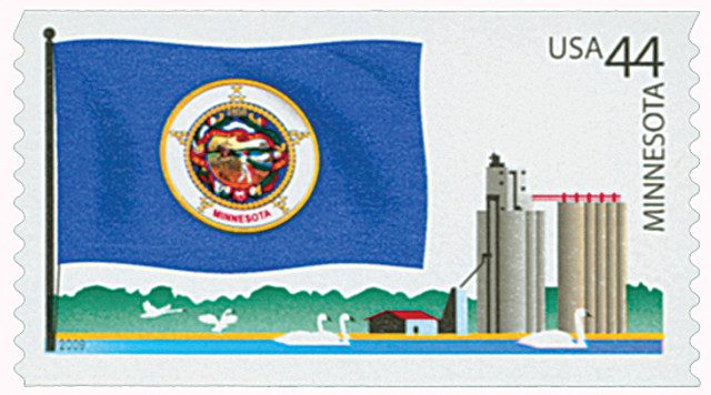
Sometimes known as the Viking state, the name Minnesota comes from the Lakota language. The root (mini or minne) means ‘water’ and ‘tÅ’ (ta) means ‘blue’. Many places in the State have similar names, such as Minnehaha Falls (laughing water or waterfall), Minneiska (white water), Minneota (much water), Minnetonka (big water), Minnetrista (crooked water), and of course Minneapolis. The State is informally known as the land of 10,000 Lakes with 11,842 lakes over 10 acres in size.
Its official motto is L’Étoile du Nord, or North Star as once proudly sported by their hockey team. Minnesota is the 12th-largest, and 21st most populous, of the U.S. States, with an estimate of 5 million people in 2015, according to the US Census Bureau.
Minnesota shares a water border with Michigan (lake Superieur), and a land and water border with Wisconsin to the east. To the south is Iowa, while North and South Dakota are to the west, and Ontario and Manitoba (Canada) define its northern border. A great day for all of us to celebrate.
I like to tell people we share a border with Minnesota and I live in Michigan.
The articles you publish are very interesting. I was fortunate to always have electricity when I was growing up in the 40’s and 50′ except when we had storms. The above ground poles were a good target for trees. Our major problems were with phone service. You first had to go thorough an operator and if you had a free line (we were on party lines) you were able to talk five minutes before being disconnected. I think the “modern conveniences” made it worthwhile.